
Last modified: 2026-06-06 by rob raeside
Keywords: parks of croatia |
Links: FOTW homepage |
search |
disclaimer and copyright |
write us |
mirrors
![[flag]](../images/h/hr_parks0.gif) image by
Tomislav Šipek, 2 September 2021
image by
Tomislav Šipek, 2 September 2021
See also:
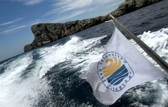
Croatian National Parks and Nature Parks are grouped under the name Parks of
Croatia (Parkovi Hrvatske).
The group consists of 8 National Parks and 12
Nature Parks.
National Parks of Croatia are:
https://www.parkovihrvatske.hr
https://web.facebook.com/ppzumberaksamoborskogorje
Tomislav Šipek, 2 September 2021
![[flag]](../images/h/hr_parks1.jpg) image by
Tomislav Šipek, 2 September 2021
image by
Tomislav Šipek, 2 September 2021
![[flag]](../images/h/hr_zprh.gif) image by
Tomislav Šipek, 2 September 2021
image by
Tomislav Šipek, 2 September 2021
As the parks are under protection, the flag with the logo of the Nature
Protection of the Republic of Croatia is also used.
https://www.vecernji.hr
Tomislav Šipek, 2 September 2021
![[flag]](../images/h/hr_npbr0.gif)
![[flag]](../images/h/hr_npbr1.gif) images by
Tomislav Šipek, 5 September 2021
images by
Tomislav Šipek, 5 September 2021
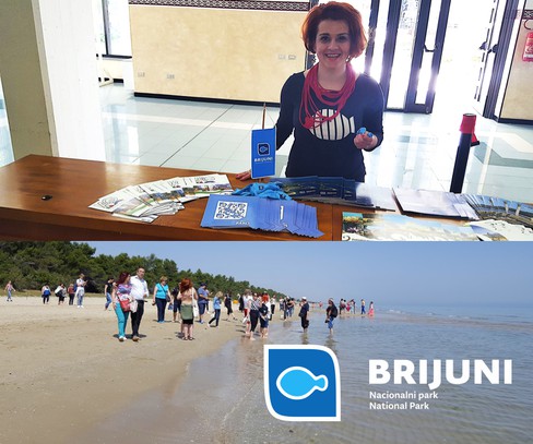
Brijuni National Park is an archipelago composed of 3 islands and 11 islets.
It is located in the County of Istria, and the area is slightly less than 34
square kilometers.
It was declared a national park on October 27, 1983.
Brijuni was known as the summer residence of Josip Broz Tito, the president of
the SFRY. Today, various political rallies are also held there, as well as
theater performances.
The flag of the Brijuni National Park is blue or
white with the park logo. The logo of the park, which at first resembles a fish,
actually shows the shape of the island of Gaz, an integral part of the Brijuni
National Park.
Tomislav Šipek, 5 September 2021
Logo
![[flag]](../images/h/hr_npbr-l.gif) image by
Tomislav Šipek, 5 September 2021
image by
Tomislav Šipek, 5 September 2021
Pennant
![[flag]](../images/h/hr_npbr2.gif) image by
Tomislav Šipek, 5 September 2021
image by
Tomislav Šipek, 5 September 2021
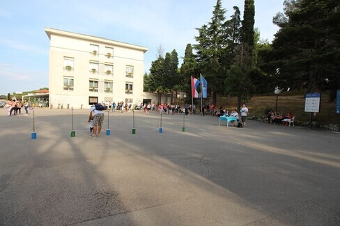
Photos
Photo 1,
Photo 2,
Photo 3,
Photo 4
Tomislav Šipek, 4 September 2021
New flag
![[flag]](../images/h/hr_npko0.gif) image by
Tomislav Šipek, 6 September 2021
image by
Tomislav Šipek, 6 September 2021
Kornati National Park consists of 89 islands, islets and cliffs and are named
after the largest island Kornat. The national park was founded in 1980, covers
an area of 220 square kilometers and is located in Å ibenik-Knin County.
The
logo is simple and represents the island group that the Kornati are. The flag is
blue. Old flag is white with old logo.
Tomislav Šipek, 6 September 2021
Old flag
![[flag]](../images/h/hr_npko1.gif) image by
Tomislav Šipek, 6 September 2021
image by
Tomislav Šipek, 6 September 2021
Logo
![[flag]](../images/h/hr_npko-l.gif) image by
Tomislav Šipek, 6 September 2021
image by
Tomislav Šipek, 6 September 2021
Photos
Photo 1,
Photo 2
Tomislav Šipek, 4 September 2021
![[flag]](../images/h/hr_npkr.gif) image by
Tomislav Šipek, 7 September 2021
image by
Tomislav Šipek, 7 September 2021
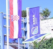
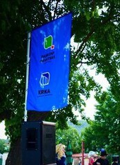
Krka National Park covers the area along the river Krka and is known for its
large number of lakes and waterfalls. It became a National Park on January 24,
1985, covers 109 square kilometers and is located in Å ibenik-Knin County. In the
area of the Krka National Park is the second oldest hydroelectric power plant
in the world, built on August 28, 1895, just three days after the first
hydroelectric power plant at Niagara Falls.
The logo represents the
waterfalls of the river Krka, while the flag is blue.
Tomislav Šipek, 7 September 2021
Vertical flag
![[flag]](../images/h/hr_npkr1.gif) image by
Tomislav Šipek, 7 September 2021
image by
Tomislav Šipek, 7 September 2021
Logo
![[flag]](../images/h/hr_npkr-l.gif) image by
Tomislav Šipek, 7 September 2021
image by
Tomislav Šipek, 7 September 2021
Photos
Photo 1,
Photo 2,
Photo 3
Tomislav Šipek, 7 September 2021
![[flag]](../images/h/hr_npml.gif) image by
Tomislav Šipek, 8 September 2021
image by
Tomislav Šipek, 8 September 2021
Mljet National Park is located in the northwestern part of the island of
Mljet. It covers an area of 54 square kilometers and is located in the
Dubrovnik-Neretva County. Mljet National Park was founded on November 11, 1960.
The logo of the Mljet National Park shows a view of the islet of Sveta Marija
(St. Mary) on the Veliko jezero (Great Lake), which is located within the island
of Mljet.
https://www.liberoportal.hr/vijesti/veliki-dan-za-mljet-stigla-voda-s-kopna-veliki-dan-za-otok-svojim-dolaskom-obiljezila-i-predsjednica-grabar-kitarovic--
Tomislav Šipek, 8 September 2021
Logo
![[flag]](../images/h/hr_npml-l.gif) image by
Tomislav Šipek, 8 September 2021
image by
Tomislav Šipek, 8 September 2021
![[flag]](../images/h/hr_npsv.gif) image by
Tomislav Šipek, 9 September 2021
image by
Tomislav Šipek, 9 September 2021
Northern Velebit National Park (Nacionalni park Sjeverni Velebit) is located
on the northern slopes of the Velebit Mountain in Lika-Senj County, and its area
is 109 square kilometers. It was founded on June 9, 1999.
The national
park logo represents a bear's paw, and uses a green flag.
Tomislav Šipek, 9 September 2021
Logo
![[flag]](../images/h/hr_npsv-l.gif) image by
Tomislav Šipek, 9 September 2021
image by
Tomislav Šipek, 9 September 2021
Photo
Photo 1
Tomislav Šipek, 9 September 2021
![[flag]](../images/h/hr_nppa.gif) image by
Tomislav Šipek, 4 September 2021
image by
Tomislav Šipek, 4 September 2021
Paklenica National Park was declared on October 19, 1949. The area covers
about 95 square kilometers and is located in Zadar County.
Paklenica is a
karst river canyon known for its rocks and so popular among climbers especially
because of the proximity of the sea.
The logo of the Paklenica National Park
itself represents the karst canyon.The flag is white with logo.
https://triprabbits.com/hr/kako-doci-do-paklenice-paklenica-hrvatska-znamenitosti-atrakcije/
Tomislav Šipek, 4 September 2021
Logo
![[flag]](../images/h/hr_nppa-l.gif) image by
Tomislav Šipek, 4 September 2021
image by
Tomislav Šipek, 4 September 2021
New flag
![[flag]](../images/h/hr_nppl0.gif) image by
Tomislav Šipek, 3 September 2021
image by
Tomislav Šipek, 3 September 2021
Plitvice Lakes National Park (Nacionalni park Plitvička jezera) was declared
on April 8, 1949 and is located 91% in Lika-Senj County and 9% in Karlovac
County. The area is about 300 square kilometers.
The park uses a flag, and it
is white with the national park logo. The logo represents a Lika bear. Flags
before and after 2014 are presented here:
https://np-plitvicka-jezera.hr/en/fznor-2/
http://www.likaplus.hr/plitvicka_j-korenica/gospodarstvo/ne_mislim_da_hoteli_moraju_ici_u_koncesiju/default.aspx
Tomislav Šipek, 3 September 2021
Old flag
![[flag]](../images/h/hr_nppl1.gif) image by
Tomislav Šipek, 3 September 2021
image by
Tomislav Šipek, 3 September 2021
Logo
![[flag]](../images/h/hr_nppl.gif) image by
Tomislav Šipek, 3 September 2021
image by
Tomislav Šipek, 3 September 2021
![[flag]](../images/h/hr_npri.gif) image by
Tomislav Šipek, 4 September 2021
image by
Tomislav Šipek, 4 September 2021
Risnjak National Park is located in the most hilly and forested part of
Croatia, in the Primorje-Gorski Kotar County. It covers 63.5 square kilometers
and was founded on September 15, 1953.
A lynx was chosen for the national
park logo, mainly because the name of the park itself actually means lynx
habitat. So far I have not found any information about the new flag, but here I
present the old flag, before 2014.
Tomislav Šipek, 4 September 2021
Logo
![[flag]](../images/h/hr_npri-l.gif) image by
Tomislav Šipek, 4 September 2021
image by
Tomislav Šipek, 4 September 2021
![[flag]](../images/h/hr_ppbi.gif) image by
Tomislav Šipek, 11 September 2021
image by
Tomislav Šipek, 11 September 2021
Biokovo Nature Park includes the eponymous mountain massif Biokovo. It was
founded in 1981, and covers 195.5 square kilometers, and is located in the
Split-Dalmatia County.
The logo of the nature park depicts Biokovo as a
mountain by the sea, which it actually is. The flag is blue with the logo while
a white table flag is also noticed.
Tomislav Šipek, 11 September 2021
White flag
![[flag]](../images/h/hr_ppbi1.gif) image by
Tomislav Šipek, 11 September 2021
image by
Tomislav Šipek, 11 September 2021
Logo
![[flag]](../images/h/hr_ppbi-l.gif) image by
Tomislav Šipek, 11 September 2021
image by
Tomislav Šipek, 11 September 2021
Dinara Nature Park is the youngest park in Croatia established on February
20, 2021. The area of the park is 630.5 square kilometers and is the second
largest park in Croatia. It stretches through Å ibenik-Knin and Split-Dalmatia
counties along the border with Bosnia and Herzegovina.It is named after the
Dinara mountain on which it is located and the name of the mountain itself
served as a toponym for the entire complex of mountains in the Western Balkans
known as the Dinarides.
For now, the appearance of the logo, as well as
the flags, are unknown, one can only guess that they could be in a green tone.
Tomislav Šipek,
21 September 2021
![[flag]](../images/h/hr_ppkr0.gif) image by
Tomislav Šipek, 13 September 2021
image by
Tomislav Šipek, 13 September 2021
Kopački Rit Nature Park is a floodplain between the rivers Danube and Drava
and is one of the largest fluvial-wetland lowlands in Europe. The area of the
nature park is about 177 square kilometers, and is located in Osijek-Baranja
County. It was founded in 1976.
The logo of the nature park represents a
white-tailed eagle (Haliaeetus albicilla), and the flag is used in both
green and white.
Tomislav Šipek, 13 September 2021
White flag
![[flag]](../images/h/hr_ppkr1.gif) image by
Tomislav Šipek, 13 September 2021
image by
Tomislav Šipek, 13 September 2021
Logo
![[flag]](../images/h/hr_ppkr-l.gif) image by
Tomislav Šipek, 13 September 2021
image by
Tomislav Šipek, 13 September 2021
Lastovo Archipelago (Lastovsko otoÄje) Nature Park consists of an archipelago
of 46 islands, islets and cliffs and a very indented coastline. It covers an
area of 53 square kilometers on land, and 143 square kilometers at sea. It is
located in the Dubrovnik-Neretva County. It was declared a park in September
2006.
The logo is represented by Peter's Fish.
The flag, for now, has not
been noticed.
Tomislav Šipek, 21 September 2021
The St. Peter's Fish, Saint Pierre, John Dory, Latin Zeus faber, has
a wide distribution around much of the world. In Europe, John Dory can be found
from Scandinavian waters throughout the North Sea (although it is uncommon in
these areas and is absent from the Baltic Sea). Its range continues through the
Mediterranean and all around the entire continent of Africa. It is found
throughout the Red Sea, Arabian Sea, Indian Ocean and parts of the Pacific. This
species is, however, not found off the coasts of North or South America.
The name John Dory (which is sometimes written entirely in lower case as john
dory) is of uncertain origin. John Dory was the subject of a folk song from the
1600s, although if there was ever any evidence of a link between this song and
the fish it has been lost over the centuries. Another theory is that the John
part of the name derives from the French word "jaune" which means "yellow". The
alternative name of St. Peter's Fish comes from an ancient legend. It is said
that St. Peter picked this fish up from the Sea of Galilee, but instead of
keeping it he returned it to the water. The black spot on the side of the John
Dory is therefore known as St. Peter's thumbprint and the species has the
alternative name of St. Peter's fish.
The black spot on the side of the
John Dory is a defensive measure, used to confuse predators by fooling them into
thinking they are looking at the eye and head of a much larger fish.
https://britishseafishing.co.uk/john-dory
British Sea Fishing
Ivan Sache, 21 September 2021
The Croatian official name for this fish is kovaÄ (smith), but locals call it
šempjer (probably from the French St. Pierre)
Tomislav Šipek, 22
September 2021
Logo
![[flag]](../images/h/hr_ppla-l.gif) image by
Tomislav Šipek, 21 September 2021
image by
Tomislav Šipek, 21 September 2021
![[flag]](../images/h/hr_pplp0.gif) image by
Tomislav Šipek, 13 September 2021
image by
Tomislav Šipek, 13 September 2021
Lonjsko Polje (Lonja Field) Nature Park is the largest protected wetland area
in the entire Danube basin with an area of ​​506.5 square kilometers. It is
located in Sisak-Moslavina County and to a lesser extent in Brod-Posavina
County, and was founded in 1998.
The logo represents a spoonbill whose nest
is a nature park. The flag is white in various variants.
Tomislav Šipek, 14 September 2021
Variant flags
![[flag]](../images/h/hr_pplp1.gif)
![[flag]](../images/h/hr_pplp2.gif) images by
Tomislav Šipek, 14 September 2021
images by
Tomislav Šipek, 14 September 2021
Old flag
![[flag]](../images/h/hr_pplp3.gif) image by
Tomislav Šipek, 14 September 2021
image by
Tomislav Šipek, 14 September 2021
Logo
![[flag]](../images/h/hr_pplp-l.gif) image by
Tomislav Šipek, 14 September 2021
image by
Tomislav Šipek, 14 September 2021
![[flag]](../images/h/hr_ppme0.gif) image by
Tomislav Šipek, 12 September 2021
image by
Tomislav Šipek, 12 September 2021
Medvednica Nature Park stretches along the mountain of the same name north of
Zagreb. It was founded on June 16, 1981, and covers the area of the City of
Zagreb, Zagreb County and Krapina-Zagorje County. It covers an area of about
179 square kilometers.
The logo represents the view of Medvednica mountain
recognized by the television tower at the top of the mountain. The flag is
green, while the older variant was white.
Tomislav Šipek, 12 September 2021
Old flag
![[flag]](../images/h/hr_ppme1.gif) image by
Tomislav Šipek, 12 September 2021
image by
Tomislav Šipek, 12 September 2021
Logo
![[flag]](../images/h/hr_ppme-l.gif) image by
Tomislav Šipek, 12 September 2021
image by
Tomislav Šipek, 12 September 2021
![[flag]](../images/h/hr_pppp0.gif)
![[flag]](../images/h/hr_pppp1.gif) images by
Tomislav Šipek, 15 September 2021
images by
Tomislav Šipek, 15 September 2021
Papuk Nature Park is located in the mountainous forest parts of Papuk, and
was declared a park on April 23, 1999. It is located on the territory of
Požega-Slavonia and Virovitica-Podravina counties, and covers 336 square
kilometers.
The logo depicts an ammonite fossil because this area was once
part of the Pannonian Sea. The flag of the park is green in various variants,
while before 2014 the white flag was used.
Tomislav Šipek, 15 September 2021
Old flag
![[flag]](../images/h/hr_pppp2.gif) image by
Tomislav Šipek, 15 September 2021
image by
Tomislav Šipek, 15 September 2021
Logo
![[flag]](../images/h/hr_pppp-l.gif) image by
Tomislav Šipek, 15 September 2021
image by
Tomislav Šipek, 15 September 2021
![[flag]](../images/h/hr_pptel.gif)
Telašćica Nature Park is a bay and the most natural port on the Adriatic and
is located in the southern part of Dugi otok (Long Island). It covers an area of
71 square kilometers, of which 45 square kilometers refers to the sea. It was
declared a nature park in 1988 and is located in Zadar County.
The logo
shows the cliffs of Telašćica, which are up to 160 meters high, and another 90
under the sea.
Flag seen at
https://radio.hrt.hr/radio-zadar
Tomislav Šipek, 19 September 2021
Logo
![[flag]](../images/h/hr_ppte-l.gif) image by
Tomislav Šipek, 19 September 2021
image by
Tomislav Šipek, 19 September 2021
![[flag]](../images/h/hr_ppuc.gif) image by
Tomislav Šipek, 17 September 2021
image by
Tomislav Šipek, 17 September 2021
Učka Nature Park is located on the UÄka mountain massif in Istria and
Primorje-Gorski Kotar County. It covers an area of 160 square kilometers and
was declared a park in April 1999. The logo shows the mountain Učka with the
Vojak tower which serves as a lookout. The flag of the park is green.
Tomislav Šipek, 17 September 2021
Logo
![[flag]](../images/h/hr_ppuc-l.gif) image by
Tomislav Šipek, 17 September 2021
image by
Tomislav Šipek, 17 September 2021
![[flag]](../images/h/hr_ppvb.gif)
![[flag]](../images/h/hr_ppvb2.gif) images by
Tomislav Šipek, 18 September 2021, 13 May 2026
images by
Tomislav Šipek, 18 September 2021, 13 May 2026
Velebit Nature Park is the largest protected area in Croatia. It stretches
along the Velebit mountain massif in the length of 145 kilometers, and covers
2270 square kilometers.
It spreads mostly through Lika-Senj County, and
through Zadar County, and to a very small extent through Å ibenik-Knin County. It
was founded on May 29, 1981. The interesting thing about the Velebit Nature Park
is that it has two national parks within its territory: Northern Velebit
(Sjeverni Velebit) and Paklenica.
The logo represents a wolf, while the flag
is white.
Tomislav Šipek, 18 September 2021
Flag seen at
https://cerovacke-spilje.hr/novosti
Tomislav Šipek, 13 May 2026
Logo
![[flag]](../images/h/hr_ppvb-l.gif) image by
Tomislav Šipek, 18 September 2021
image by
Tomislav Šipek, 18 September 2021
Vrana Lake (Vransko jezero) Nature Park includes the largest natural lake
with its surroundings in an area of 57 square kilometers. It was declared a
park in 1999, and is administratively located in Zadar and Å ibenik-Knin
counties.
The logo is represented by the heron as the most characteristic
bird species among the hundreds that nest on the lake.
The flag, for now, I
have not yet noticed in use.
Tomislav Šipek, 20 September 2021
Logo
![[flag]](../images/h/hr_ppvr-l.gif) image by
Tomislav Šipek, 20 September 2021
image by
Tomislav Šipek, 20 September 2021
![[flag]](../images/h/hr_ppzu.jpg) image by
Tomislav Šipek, 16 September 2021
image by
Tomislav Šipek, 16 September 2021
Žumberak - Samobor Highlands Nature Park (Žumberak - Samoborsko gorje) is
located in a hilly area along the border with Slovenia. It is mostly located in
Zagreb County, and to a lesser extent in Karlovac County. The park covers 350
square kilometers and was opened on May 28, 1999.
The logo represents the
gentle hills of these two mountains, and the flag is white.
Tomislav Šipek, 16 September 2021
Logo
![[flag]](../images/h/hr_ppzu-l.gif) image by
Tomislav Šipek, 16 September 2021
image by
Tomislav Šipek, 16 September 2021